Location
Tessel Crossing, Lorem City
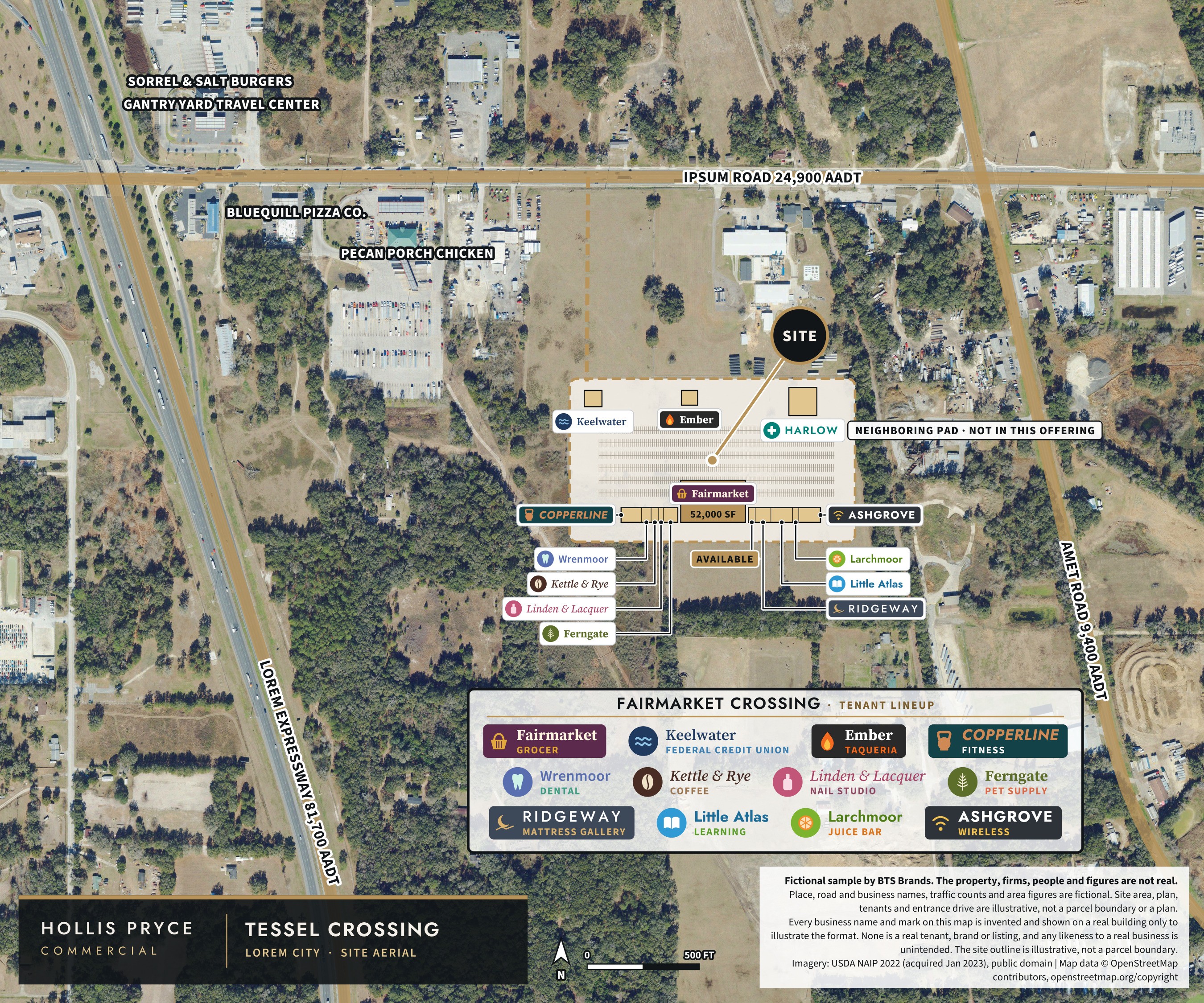
Fairmarket Crossing sits at Tessel Crossing in northwest Lorem City, on Ipsum Road about a quarter mile from Lorem Expressway Exit 12. 24,900 vehicles a day pass the frontage, with the district’s office and hotel phases behind the center.
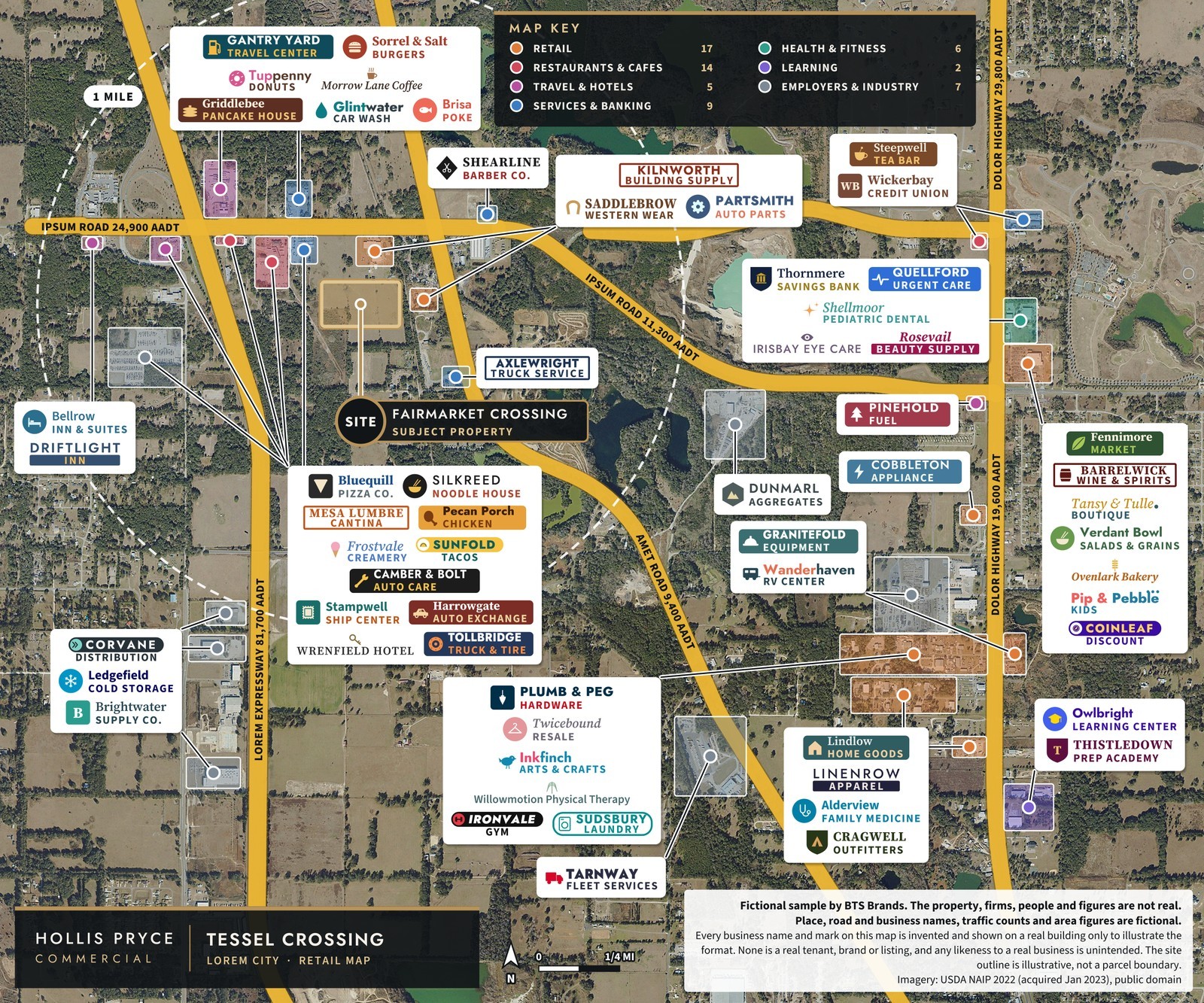
One entrance drive serves the parking field in front of the storefront row; the two pads sit at the frontage with their own drive-thru and patio lanes. The surrounding retail is a mix of daily-needs, service and dining uses shown on the retail map below.
Fictional sample
Imagery: USDA NAIP 2022 (acquired Jan 2023), public domain | Map data © OpenStreetMap contributors, openstreetmap.org/copyright. Place, road and business names, traffic counts and area figures are fictional. Site area and entrance drive are illustrative, not a parcel boundary or a plan.Area demographics
| 1 mile | 3 miles | 5 miles | |
|---|---|---|---|
| Population | 1,240 | 12,870 | 38,410 |
| Households | 468 | 4,930 | 14,620 |
| Median household income | $52,300 | $57,400 | $54,900 |
| Average household income | $71,900 | $79,800 | $78,200 |
| Median age | 41.6 | 43.9 | 43.2 |
Ring figures are fictional.
Traffic: 24,900 vehicles a day on Ipsum Road at the center’s frontage. Traffic counts and place and road names are fictional.
Nearby
Retail, services and access
Fictional sample
Imagery: USDA NAIP 2022 (acquired Jan 2023), public domain. Place, road and business names, traffic counts and area figures are fictional. Tenant marks and the site area are illustrative.Access
- Single entrance drive from Ipsum Road to the parking field (illustrative plan).
- Anchor loading at the rear of the grocer; in-line service doors on the back of the storefront row.
- Pads P-1 and P-2 face the frontage, with the credit union's drive-thru lane on the outer pad.
The district

Fictional sample
Imagery: USDA NAIP 2022 (acquired Jan 2023), public domain | Map data © OpenStreetMap contributors, openstreetmap.org/copyright. Place, road and business names, traffic counts and area figures are fictional. Site area and entrance drive are illustrative, not a parcel boundary or a plan.